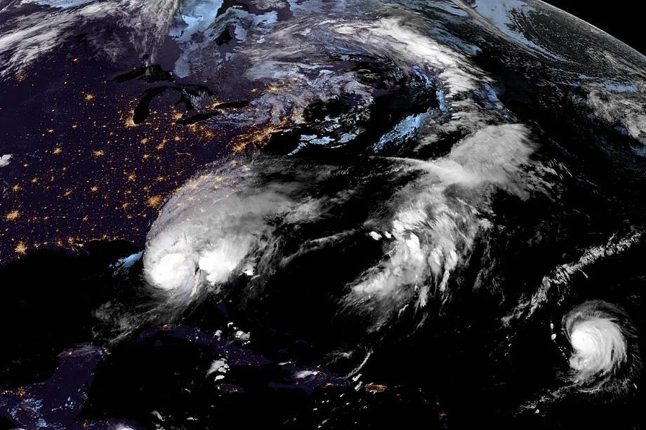
Hurricane Milton has made landfall in Florida, leaving cities affected by severe flooding. More than two million homes and buildings are without electricity, and thousands of damages have occurred.
Fortunately, Milton made landfall near Siesta Key, in Sarasota County as a Category 3, but as it moved through Florida, it weakened to a Category 1.
In any case, you can still observe Hurricane Milton's path in real-time as well as its trajectory.
How to see Hurricane Milton in real-time via satellite
To follow Hurricane Milton's evolution in real-time, you can visit the website windy.com. Once on the website, simply click on the menu button located in the upper right corner.
When the options appear, select "Hurricane Tracking", which will be the first option.
There you can see the real-time tracking of active hurricanes.
Another website that allows you to see Hurricane Milton via satellite is Zoom Earth. This site allows you to see its current category and the path it has taken over the past few days.
Hurricane Categories: Classification and Damage According to the Scale
Hurricanes can have different categories based on their intensity, measured on the Saffir-Simpson scale.
This scale, developed in 1969 by Hervert Saffir and Bob Simpson, classifies hurricanes into five categories based on wind speed and storm surge, as detailed by the National Hurricane Center of the United States.
Category 1 hurricanes are the least intense with winds up to 153 kilometers per hour. On the other hand, Category 5 hurricanes are the strongest. For example, Hurricane Mitch was of this category.
