The earthquake that shook Myanmar a week ago was a "special" type of strike-slip fault, with a rupture about 450 kilometers long in only 80 to 90 seconds, causing intense effects in places located over a thousand kilometers from the epicenter, such as Bangkok, according to the latest data.
In the Thai capital, a building under construction completely collapsed and many buildings swayed, leaving the peculiar image of water from several rooftop pools cascading down, despite the distance from the earthquake's epicenter.
Seismologist Lucía Lozano, from Spain's National Seismic Network, explains to Efe that although the earthquake originates at one point, it actually is a "rupture front" that propagates along the entire fault.
Myanmar is located above the Sagaing Fault, a more than 1,200-kilometer fracture in the terrain that crosses the country from north to south between the Indian and Eurasian plates, which move horizontally against each other, defining it as a strike-slip fault.
"The most recent studies being conducted now seem to indicate that this type of earthquake is a somewhat special type of strike-slip fault, in which the rupture travels very quickly," Lozano points out.
The rupture was of a large size, about 450 kilometers long by 15 wide, and faster than usual, in approximately 80 to 90 seconds.
Experts like German seismologist Frederik Tilmann even described it as "the earthquake equivalent of a supersonic plane."
This, combined with the high magnitude of the tremor (7.7), "may have caused extensive damage over a wide area," explains Lozano.
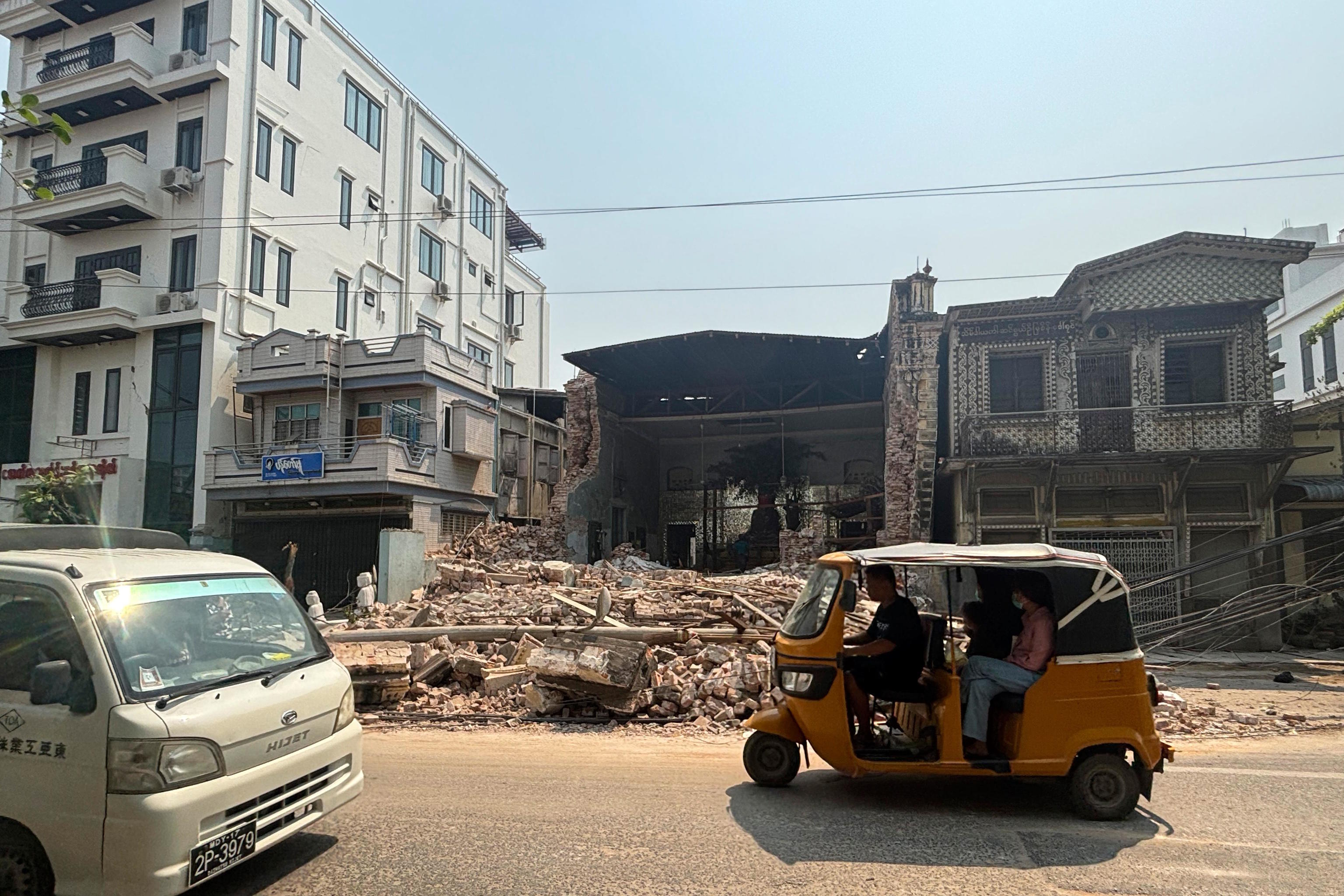
In Myanmar itself, the effects have been devastating, with over 3,000 dead, thousands injured, and several hundred missing.
Lozano points out that the type of soil in the area also influences the level of devastation, and in the case of Myanmar, the U.S. Geological Survey warned of a "very high" probability of land liquefaction landslides.
"Liquefaction is a phenomenon that occurs in water-saturated loose soils, causing the ground to lose stability. It's like when you step on wet sand, and then the water rises, right? So, this increases the risk of building collapses," she explains.
The earth may continue to shake
The area has experienced dozens of aftershocks in the past week, the highest being a magnitude 6.4 that occurred just 10 minutes after the main tremor.
The seismologist warns that in earthquakes of such high magnitudes, aftershocks can continue "for months, even a year or more," so the earth may continue to shake in Myanmar.
"Usually, the number of aftershocks decreases over time, but it's never ruled out that there may be periods where the number of aftershocks is higher or the magnitudes are slightly higher," she explains.
An earthquake of such magnitude releases a large amount of energy, destabilizing the area and redistributing accumulated tensions in the crust regionally.
Additionally, this occurred in an area with high seismic activity and significant plate movement, almost ten times more than in Spain.
"In this area, the relative movement of one plate compared to another is estimated at around 3 to 4 centimeters per year, which is much faster compared to how the Eurasian and African plates move in the Iberian Peninsula area, where plates move about 5 millimeters per year," the seismologist points out.
This high seismicity is evident in the historical records of the area, with six earthquakes with a magnitude of 7 or higher in the last 125 years, the largest being in 1912 (7.9).