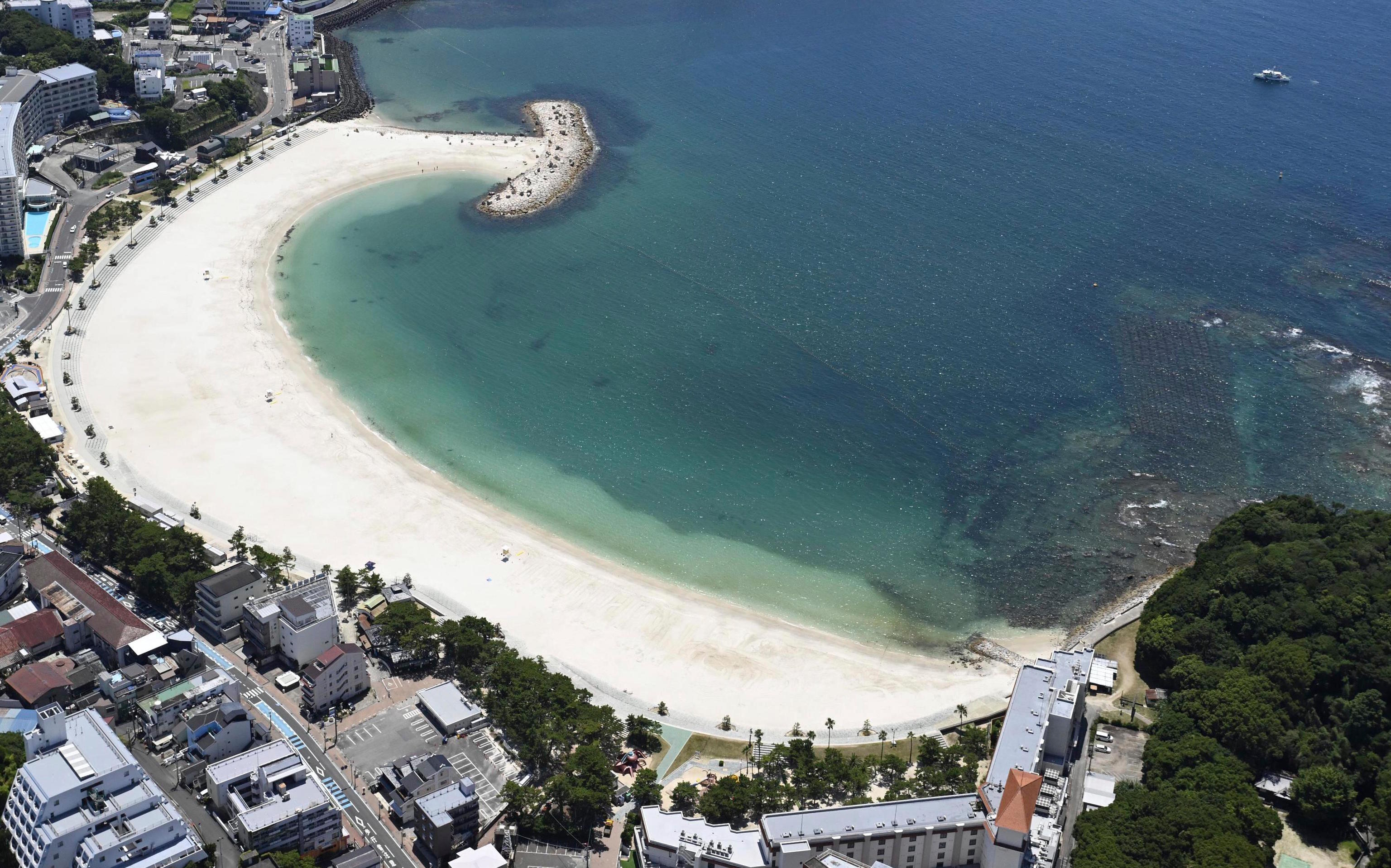
Just a few minutes after the first tsunami alerts went off on Wednesday morning in several coastal regions of Japan, two drones began flying over Ichinomiya beach, covering the 7.5 kilometers of coastline multiple times. They carried speakers to warn beachgoers to evacuate immediately and seek higher ground for shelter.
Ichinomiya, in Chiba prefecture, was one of the Japanese cities that ended up submerged after the devastating 2011 earthquake and tsunami. Following the catastrophe, authorities realized that they could not ensure that conventional alert systems, such as mobile text alerts and sirens, reached people on the beach. They then decided to create their own disaster signal system based on drones. This system would connect to the national real-time emergency alert network, the well-known J-Alert, recognized worldwide for its speed and reach.
In Ichinomiya, over 270,000 euros were spent to hire a technology company from Tokyo to install specialized drone stations on the rooftops of municipal offices and a school. Every time an earthquake or tsunami alert is issued, two drones autonomously take off and patrol the entire coast sounding their distinctive horn.
Just ten minutes after the powerful magnitude 8.8 earthquake shook the Kamchatka Peninsula coast in Russia, the Pacific Tsunami Warning System, coordinated by UNESCO, issued an initial warning covering the highest-risk areas, particularly the Russian and Japanese coasts. Within 20 minutes, the threat of large oceanic waves was relayed to national centers along the Pacific coast, immediately activating evacuation protocols in many countries.
After one of the most powerful earthquakes ever recorded shook the entire Pacific this week, international disaster experts agree that the positive note of this major scare has been the success of the alert systems in the affected countries, from Japan to Chile, including the clear warnings broadcasted on Hawaii television.
UNESCO also highlighted that its alert system, in coordination with national systems, quickly spread to all corners, providing detailed forecasts of wave heights and flooding. "This timely alert once again demonstrates the crucial role of international scientific cooperation in the face of natural hazards," said Audrey Azoulay, Director-General of the UN agency, which relies on a vast network of sensors and tide gauges covering the Pacific, Indian, Caribbean, Northeast Atlantic, and Mediterranean basins, created after the 2004 Indian Ocean tsunami, which claimed over 220,000 lives.
The J-Alert was also launched in 2004 by Japan's Fire and Disaster Management Agency (FDMA), which receives real-time information from various national and international agencies on all types of emergencies (including North Korean missile launches) and transmits the data via satellite networks to ground stations distributed throughout the country.
In Hokkaido, northern Japan, all tsunami alarms were immediately activated on Wednesday after the earthquake, warning of waves up to three meters high (they ultimately did not exceed one and a half meters). The J-Alert system quickly sent alerts to mobile phones, and its sister app, Safety Tips, did the same in English and other languages for residents and foreign tourists. In Japan, as in China and other Asian countries, it is common for many municipalities to also send weather alerts to mobile phones, especially in the case of storms or extreme heat.
"Since the Fukushima nuclear accident in 2011, there is legislation that everyone knows and that establishes very clear rules on emergency management responsibilities, ensuring a rapid and coordinated response at all levels. Additionally, all Japanese people are perfectly familiar with evacuation protocols because many drills are conducted," explains Spanish researcher Carmen Grau, who has been dedicated to disaster management at Waseda University in Tokyo for 15 years. Her work involves gathering information on how the Japanese prepare for natural disasters, with the aim of applying their methods in other countries.
The researcher explains that safe evacuation points are established in all cities and towns in Japan. In case of a power failure during emergencies, all localities have radios in schools, sports centers, and community centers to communicate. Additionally, government technicians visit municipalities every year to conduct workshops on how to coordinate evacuation and rescue operations.
"One of the secrets to Japan's early response success is prior preparation. Schools provide courses, and companies train their employees on how to act in the event of strong typhoons, earthquakes, etc. When significant alerts are issued, companies prioritize employee evacuation above all else and halt production," the expert continues.
Whenever there are earthquake or tsunami alerts in Japan (a country located on four tectonic plates where there are around 1500 earthquakes per year, although the vast majority go unnoticed), in addition to using the J-Alert system, authorities project animated educational videos in multiple languages on how to respond to disasters in trains, airports, and tourist centers. Another particularity is that evacuation guides and maps of safe shelters in case of earthquakes or tsunamis can be found prominently displayed in hotels, public buildings, and train stations.